Showing posts with label Piha. Show all posts

Sunday, 28 February 2021

Karekare - Comans Track - Mercer Bay Loop - Ahu Ahu Track

Date: 26 February 2021

Party: Anna, Elizabeth, Lesley

Map: https://www.alltrails.com/explore/trail/new-zealand/auckland/ahu-ahu-track-to-comans-track-loop
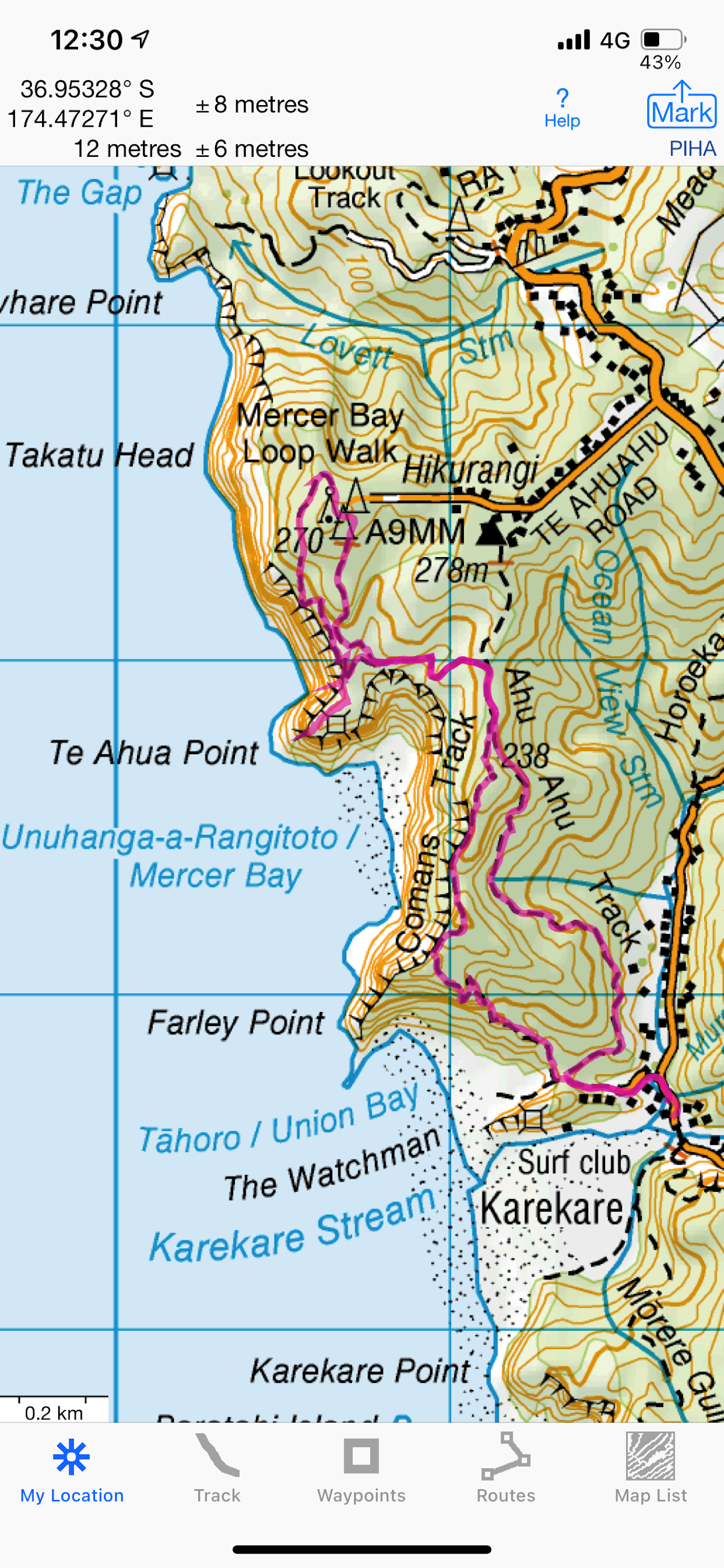

Distance/Elevation/Time: 7.29k; 260m approx; 2 hours and 20 minutes


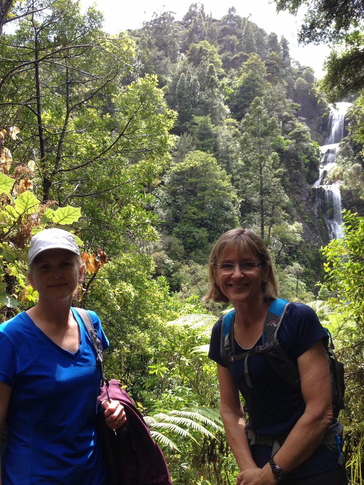
Notes: Could this be any more spectacular? Another sublime summery day. It feels like an age since we have been able to walk along this coast and see all the different iconic West Coast beaches. This is such a New Zealand walk at this time of year:

Hot and humid 👍

Turquoise sea 👍

Black sand 👍

Toitoi (native and fake) 👍

Flax 👍

Manuka 👍

Isolated beaches 👍

Recent surfer near-tragedy 👍

Impressive waves 👍

Vow to self never to swim a West Coast beach  👍👍

A short walk today, but lots of stairs and plenty of elevation. Magnificent views, every way you look. In fact, it was quite a shock to gain a small amount of elevation and take in the waves rolling in across a pristine beach. A reminder of how much we have missed this area. It's a popular track, which is the exception for most of our Friday walks, AND we met two members of the group we ran into last week! Not the stick-insect abusers, luckily. We had a quick snack at Te Ahua Point, with dignified company, and then headed off to complete our circuit. Coffee at the Piha Cafe, which has always been a favourite. We went back to the car and were asked by a local to run her up the (extremely steep) road to her house. Got her whole life story in about 3 minutes. Friendly as.


Saturday, 3 September 2016

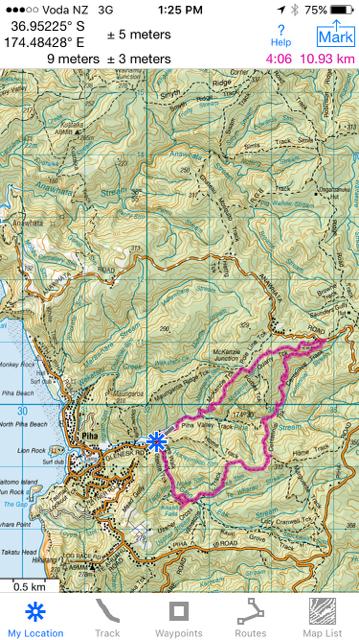
Piha Rd car park – Upper Huia Dam Track – Upper Huia Reservoir – Tunnel - Lower Huia Reservoir - Smiths Road Bridge - Return

Date: September 2, 2016
Party: Anna, Lesley
Maphttp://nztramper.com/upper-huia-dam-track-christies-track-upper-nihotupu-walk-waitakere-ranges/
Distance: 16.5 kms
Elevation: Not sure
Time: 5 hours 20 minutes
Notes:
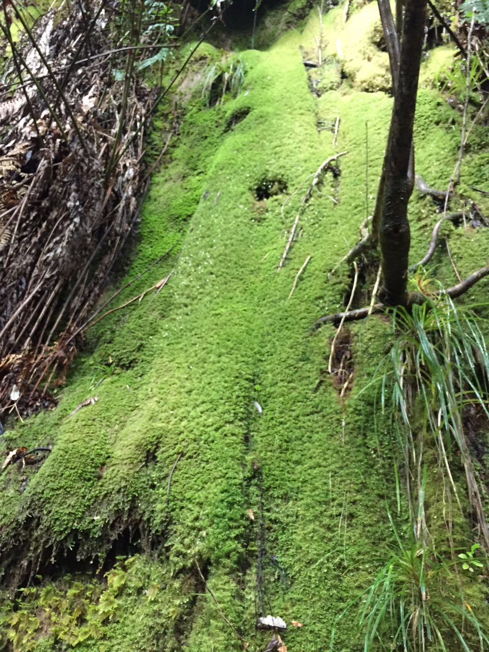
For a number of reasons, we have not headed out West for what seems like an age. So even as the clouds gathered ominously, and the country headed to higher ground after a 7.1 magnitude earthquake off the East Coast, we cheerily drove off for an extended visit to the West. The Te Atatu motorway exit has become such familiar territory, as have Lincoln Road, the railway underpass, and the left-hand turn at the Gull service station, where you can relax after spotting the Piha sign. So it's almost unimaginable that we still have to give it serious thought before we commit to the off-ramp! (Perhaps our insistence on ignoring the GPS lady has something to do with it...) The walk Anna had chosen was one we have not previously done, which is pretty strange, given the territory that we have covered over the years. We decided to do only a part of it today, as a recce - to go as far as we felt like and then turn back. We'll do the longer walk shown in the map when Elizabeth is available. One of the things we have come to realise is that if there is a sign at the start of a Waitakere track saying 'experienced trampers only' you are guaranteed mud, tree roots, stream crossings, steep terrain, narrow paths, splendid isolation, and a full-body workout. So no surprises about five minutes into the track when we were fully concentrating on our foot placements between tree roots, and sliding (ok, and squealing) down the rest of the track. In the rain. But what a beautiful track! Fantastic bush, with several stream crossings, and water rushing along the gullies. Mossy banks, a lovely pool and a man-made cave, before there were peeks of dam, and great stretches of still water. We walked the length of the dam to check the track at that end - still closed due to Kauri die-back - and getting pretty overgrown. We descended to the Watercare buildings, and strolled on to find a spot for morning tea. Enter a white Watercare car. Exit a Watercare car. Followed about 20 minutes later by a Park Ranger and a passenger. Turns out they were looking for a suitable environment for Hochstetter frogs, who need still water, a shingle riverbed, and things to hide under. That got our curiosity going and we spent a bit of time as we walked considering suitable places for them. There was a tunnel a little further along the track to the Lower Huia Dam, which of course we had to investigate. A sign warned us that we needed industrial-strength safety helmets before we could dare enter the Beast. We ignored this (naughty) and found we didn't even need the torches we had carefully packed. No glow worms either. I did like the warning about soil and rocks 'frittering' into the tunnel though. Like they had nothing better to do. We reached the Lower dam after one of those boring forestry roads that mess with your mind - they just leave nothing to the imagination in terms of interest or destination. This dam is one we have visited before, and is full of reeds, probably eels, and is lovely in the sunlight. (Yes! thank you Auckland weather!) We had lunch back at the Watercare buildings, in the sun, and ANOTHER Watercare vehicle drove up...this time to test the water. Given the recent problem in Hawke's Bay, it was reassuring to hear that the water here is tested every two weeks for greeblies. Having consumed our lunches, we steadied ourselves for the ascent into the mud, CSI Meadowbank tracking the Ranger's passenger (who we decided must be a global expert on Hochstetter frogs) as we went. 


Saturday, 23 January 2016

Glen Esk Road - Piha Valley Track - McKenzie Track - Quarry Track - McElwain Lookout - Centennial Track - Home Track - Connect Track - Kitekite Falls - Kitekite Falls Track - Glen Esk Road Car Park

Date: January 22, 2016
Party: Anna, Lesley
Map:


Distance: 11km
Elevation: 0-350 + 100-270 = 520 total


Time: Just over 4 hours, but we had an instagram stop (!) AND a longer lunch break than usual to watch the abseilers.

Notes: We are feeling the hot breath of Moss Pass in Nelson Lakes (March 2016) on our backs, so our first walks of the year are focused on elevation. Hills, and more hills. And lots of steps, just to mix it up. We discovered that the elevation difference between Blue Lake Hut and Moss Pass is about 600m (Moss Pass is 1785m high, Blue Lakes Hut is at 1190m, and it's about 1.7 km to the peak), so we are trying to make sure that we have a sense of how high and far it is, to consolidate our confidence. No paranoia here.... 

This is one of those walks you could recommend to someone else with a clear conscience. It has everything, and can be shortened or lengthened depending on what you want to do. The view from the lookout is amazing - we could see Te Toiokawharu in the distance and the west coast beaches stretching off to the right, with Piha directly in front of us. Hard to believe it had only taken a short while to get so far from where we had parked. We ran into Black Rock Dam on Centennial Track, which was in great shape - the water really clear and the remnants of the dam clearly visible in the structure. We wanted to have lunch at the falls, and joined the crowds of people (yes, crowds) soaking in the pools or canyoning or lounging on the rocks. What a novelty to come across anyone else! And as we walked down, we came across plenty of others headed up for a dip. The day was incredibly hot - late 20s - so that water looked pretty inviting. We loved the abseilers - one minute there was a sedate group of children splashing around, next there was a succession of people whizzing (or not) down the side of the falls. The instructor came down the ropes in the picture in about 3 seconds. We had coffee and gingerella (ok, and ginger crunch) at the Piha Cafe, which was really busy too - obviously we have never been to Piha in the summer! A great start to the tramping and walking year. Man, have we got plans!!


Gingerella
Steps up from the Dam
Kitekite Falls as we have never seen them before!

Black Rock Dam
Moss
So graceful!
Boulder Blonde
Upstream
Scribbles!
Found washed up on a log...


Friday, 20 February 2015

Glen Esk Car Park - Kitekite Falls - Connect Track - Winstone Track - Kauri Grove Track - Marguerite Track - Home Track - Car Park


Date: 20 February 2015
Party: Anna, Elizabeth, Lesley
Map: 

Distance: 8.2 km
Elevation: Not much
Time: 3h and 10min dawdle (still getting back into it)
Notes: Anna was feeling uninspired this week (what with the house on the market and rubbishtruck drivers to contend with) so we redid this walk of ages ago. It's a pleasant enough walk, especially at the start where there are lots of kauri (apparently the only vegetation not cleared off the land at one stage) and the Kitekite falls, but is pretty much a rugged, canopied bush walk without stunning views. Still, not too many streams to cross, only a bit of mud, and a couple of ok spots for a snack. Not too much up, and not too much down. We adjourned to Elevation, a restaurant we have driven past many times before and thought we would try this time round. Don't be tempted. The view from the balcony is brilliant, but your wedding deserves so much more.

Piha - Pararaha Valley - Via the Swamp - Along the Beach

Date: February 13, 2015
Party: Anna, Elizabeth, Lesley
Map:
Distance:
Elevation:
Time:
Notes: One of our favourite walks, as it includes the Pararaha Valley, The Swamp AND a tunnel, but I swear that walk through the sand was not there last time.

Friday, 28 November 2014

Kitekite Falls - Connect Track

Date: November 28 2014
Party: Anna, Elizabeth
Map: Kitekite Falls
Distance: 4.5km?
Elevation:
Time: A couple of hours?
Notes: Unbelievably, it was raining when we set off, and got worse as we headed into Piha. Stopping for coffee here to consider our options, we decided to do the Kitekite Falls rather than other, muddier walks...and watched from the cafe as the grey sky blued up and the sun came out. Anna performed a 5 point turn in the car park to get around the delivery man, and off down Glenesk Road we went. The falls are not too far up the track and they were stunning in the (sun)light. We carried on to Connect Track, which is pretty straightforward, had brunch (Anna experimenting with Nairns Oat Biccies and...dates?), and then took the slippery slope of a track back down to the car. Excellent.


Saturday, 8 November 2014

Lone Kauri Road Loop (anti-clockwise): Buck Taylor Track - Pararaha Valley Track - Muir Track - Walker Ridge Track - Odlin timber Track

Date: 7 November 2014
Party: Anna, Debra, Lesley
Map:

Distance:10-11km
Elevation: up to approx. 270
Time: 5 hours
Notes: We did this tramp last year, in December, and it's lovely (and long). One of the great aspects of having spent so much time in the Waitakere area, is that you start to notice the seasonal changes more, and put together a sort of mental jigsaw of the place as you get to know more about what grows there and what it looks like in different phases. As we now know a wee bit about Taraire, we seem to see it everywhere (having largely ignored it), and now we have added kowhai into the mental bin, I think we will be much more aware of that too. We were surprised how few tuis and wood pigeons there were, until we came across a carpet of yellow flowers...and, of course, there were the birds.

This tramp is a circuit, incorporating part of the Pararaha Valley that we really like (except after rain). We walked down to our favourite swampy bit and sampled Anna's experimental Tararua Biscuits (we are staunch guinea pigs), which were perfect. I hope four days of just Tararua biscuits on the Kepler will not have her gnawing on not-biscuits. We thoughtfully introduced Debra to Waitakere mud, which she thoroughly enjoyed...there was yellow mud, brown mud, red mud, and even some cute little channels that tested your footwork. We had thought of everything. We were also delighted to see that she loved the staircases as much as we do, although one of our group was overheard talking about "enjoying the pain". It wasn't Debra. Or me.

Having finished the tramp, we retired to Henderson to find some hot cafes that Anna had in her Little Black Book, but were about half an hour too late. Unfortunately, we were forced to have light refreshments at Gloria Jeans, where there were several unbecoming incidents involving a refusal to rehydrate in this establishment and a disconcerting exercise demonstration. Enough said.


Saturday, 13 September 2014

North Piha Beach - Laird Thomson Track - Te Waha Point - Rose Track - Anawhata Road - White Track - North Piha Beach

Date: 12 September 2014
Party: Anna, Debra, Lesley
Map: 


Distance: 6.5 km
Elevation: 


Time: 2 hours
Notes: We had intended to do a Pararaha Valley walk, but decided that the rain might flood the swampy areas and make the stream and boardwalk impassable (and probably unfindable). So we went to Piha instead. A very misty, showery day and what an explosion of birdlife! - the tuis were raucous. We headed east of Lion Rock, and found the elusive entrance to Laird Thomson Track in the undergrowth. The ascent gave us lovely views over Piha and Whites Beach, and from Te Waha Point we could see right up the coast. We decided that the view of Whites Beach was enough for the day, and headed straight up a concrete track to Anawhata Road and the almost immediate descent to morning tea on White Track in a fantastic nikau glade. We managed to miss the rain thanks to an early start (7.30am at Shore Rd - outrageous) and only got slightly damp on the walk back to the car. We revisited the Piha Cafe, and were generously shouted coffees by Debra. Thanks! Good training for the Kepler in December, and a nice, green, mountainous memory for Anna before she heads off to Venice.


Saturday, 18 May 2013

Whites Beach and Te Waha Point

Date: 29 January 2013
Party: Anna G
Map:


Distance: 6km (mostly loop)
Elevation:
Time:
Notes:

Maungaroa Ridge and Lookout

Date: 10 March 2012
Party: Anna G, Elizabeth W, Lesley V
Map:
Distance:
Elevation:
Time:
Notes: