![]() |
| The view from Treble Cone |
Thursday, 27 August 2015
Mt Iron, or, the Waitakere Three go to Wanaka
Saturday, 15 August 2015
Lamb Chop Walk
Date: 14 August 2015
Party: Anna, Elizabeth Lesley
Time: About an hour & 15
Walk the external and internal perimeters of Cornwall Park - Check
Find a lambiewambie or two and contemplate their cuteness...and readiness for the oven - Give them a few weeks..
Enjoy the daffodils, jonquils and erlicheer on Twin Oaks walk - Check, check, check
Determine progress on the Fairy Circle cherry trees - Not a blossom in sight
Responsibly rehydrate at the cafe - Check
All missions accomplished.
Monday, 3 August 2015
Mischief Managed - Twin Peaks Track - Huia Ridge Track - Karamatura Track - Tom Thumb Bypass Track - Car Park
Date: 31 July 2015
Party: Anna, Elizabeth, Lesley
Map:
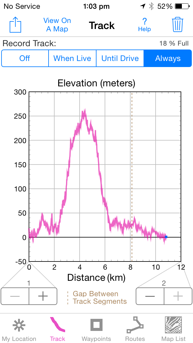
Elevation:

Distance: 13 km
Time: 5 hours 45 minutes
Notes: This was a killer walk. It was a variation on the 'not-for-the-faint-hearted' track we did prior to the Kepler last year, with what we thought was a shorter track back to the start after summitting. Nope. Multiple peaks up to the highest point of the Waitakeres (Te Toiokawharu) make for a bit of a slog in the mud, but the vegetation is classic awesome Waitaks - lots of supplejack, rimu and kauri (especially our favourite friend, Tom Thumb), with epiphytes everywhere. (And don't mention the bark competition). Great boardwalk too, along Huia Ridge, with patches of kidney fern just in this area. This is quite an overgrown piece of track, which is sort of swampy and full of tree roots and places for pigs to hide (paranoid? me?) Yes, the piggy diggings were extensive in the lower parts of this track (the upper being too much clay and rocks), and we saw some wee trotter imprints here and there. Sticks were carried. There was not much in the way of bird life - why IS that? Sometimes it's a chorus and other times it's incredibly silent. We also came across a strange black fungi on some rotten logs which we haven't seen before. Too tired to take a photo. Elizabeth managed to surprise us hanging upside down on the track at one stage - she had caught her foot in a tree root, smacked her head on a rock and was busy extricating herself when we realised what we were seeing. Blood sacrificed. We finally reached the car, and collapsed into the Huia Cafe for some caramel slice and a warm drink. Next time Anna mentions Tom Thumb I am going to be washing my hair.


Party: Anna, Elizabeth, Lesley
Map:
Elevation:
Distance: 13 km
Time: 5 hours 45 minutes
Notes: This was a killer walk. It was a variation on the 'not-for-the-faint-hearted' track we did prior to the Kepler last year, with what we thought was a shorter track back to the start after summitting. Nope. Multiple peaks up to the highest point of the Waitakeres (Te Toiokawharu) make for a bit of a slog in the mud, but the vegetation is classic awesome Waitaks - lots of supplejack, rimu and kauri (especially our favourite friend, Tom Thumb), with epiphytes everywhere. (And don't mention the bark competition). Great boardwalk too, along Huia Ridge, with patches of kidney fern just in this area. This is quite an overgrown piece of track, which is sort of swampy and full of tree roots and places for pigs to hide (paranoid? me?) Yes, the piggy diggings were extensive in the lower parts of this track (the upper being too much clay and rocks), and we saw some wee trotter imprints here and there. Sticks were carried. There was not much in the way of bird life - why IS that? Sometimes it's a chorus and other times it's incredibly silent. We also came across a strange black fungi on some rotten logs which we haven't seen before. Too tired to take a photo. Elizabeth managed to surprise us hanging upside down on the track at one stage - she had caught her foot in a tree root, smacked her head on a rock and was busy extricating herself when we realised what we were seeing. Blood sacrificed. We finally reached the car, and collapsed into the Huia Cafe for some caramel slice and a warm drink. Next time Anna mentions Tom Thumb I am going to be washing my hair.
| Looking back to Huia |
| Tom Thumb..oh and Anna |
Saturday, 25 July 2015
Te Henga (Bethells) - Wainamu Lake - Houghton Track - Wainamu Junction + Return via the opposite side of the lake
Date: 24 July 2015
Party: Anna, Elizabeth, Lesley
Map:
Distance: 10.5 km
Elevation:
Time: 3.5 hours
Notes: This is one of our favourite tramps. The black sand dunes are amazing (and who could not love that loo...). There is a huge nikau glade, fabulous swimming 'pools' that are really popular during summer, a Maori carving and even Barbie holidays here. Coming back to the car around the dunes from the other direction means a bit of a slosh through the stream, as there is no path other than up and over some pretty steep dunes. We managed to take a timed selfie (cos that is how we roll) which was entertaining. On our way back past the lake we met some nice regional council staff who were installing some kind of telecommunications equipment so that they are sent digital information about the lake - temperature, etc, rather than having to check their instruments manually, so we finally established what the buoys were for in the middle of the lake. There are apparently heaps of fish, but not native species - carp and perch - and they are quickly taking over. The water was amazingly clear though.
Party: Anna, Elizabeth, Lesley
Map:
Distance: 10.5 km
Elevation:
Time: 3.5 hours
Notes: This is one of our favourite tramps. The black sand dunes are amazing (and who could not love that loo...). There is a huge nikau glade, fabulous swimming 'pools' that are really popular during summer, a Maori carving and even Barbie holidays here. Coming back to the car around the dunes from the other direction means a bit of a slosh through the stream, as there is no path other than up and over some pretty steep dunes. We managed to take a timed selfie (cos that is how we roll) which was entertaining. On our way back past the lake we met some nice regional council staff who were installing some kind of telecommunications equipment so that they are sent digital information about the lake - temperature, etc, rather than having to check their instruments manually, so we finally established what the buoys were for in the middle of the lake. There are apparently heaps of fish, but not native species - carp and perch - and they are quickly taking over. The water was amazingly clear though.
Saturday, 18 July 2015
Anawhata Road - Kuataika Trig - Wainamu Junction + Return
Date: 17 July 2015
Party: Anna, Elizabeth, Lesley
Map:

Distance: 10.4 km
Elevation: 276m at Wainamu Junction
Time: 3 hours and 55 mins
Notes: Our initial plan was to walk through to Lake Wainamu and back, but the rain, conditions and need to be back by 4pm were against us and we only went to the Junction. Hopefully next week we can start at the other end and complete this section of the Hillary Trail. The track starts (unusually) with a paddock, and a brilliant view of the coast. It was pretty clear, though, from the valley in front of us, that there would be some peaks and troughs in this walk, and so there were (literally and metaphorically)! The track is wide, most probably a 4-wheel drive track, and it is rocky, muddy and slippery. This is not a track to do after heavy rain. We descended quickly to the valley floor, having to watch every step, crossed a small river or two, then ascended to the trig. This section was a bit of a slog through regenerating bush...there were lots of juvenile natives, but also lots of gorse, cutty grass, manuka and kanuka. The trig gives you a panoramic view of the coast and valley, and is a great place for morning tea. We were lucky enough to enjoy no wind and bright sunshine at the trig (must have been in Auckland) so we could mentally have some respite from all that slippery mud. Back down to the track and we continued our ascent to the Junction. Decision made to turn around at this point, we retraced our steps, with several bone-jarring falls that confirmed our position of glad-we've-done-it-but-never-again. All you can say about this trip is we are getting better at stream crossings. Boom. That's it. Back to Little Sister Cafe to celebrate.
Party: Anna, Elizabeth, Lesley
Map:
Distance: 10.4 km
Elevation: 276m at Wainamu Junction
Time: 3 hours and 55 mins
Notes: Our initial plan was to walk through to Lake Wainamu and back, but the rain, conditions and need to be back by 4pm were against us and we only went to the Junction. Hopefully next week we can start at the other end and complete this section of the Hillary Trail. The track starts (unusually) with a paddock, and a brilliant view of the coast. It was pretty clear, though, from the valley in front of us, that there would be some peaks and troughs in this walk, and so there were (literally and metaphorically)! The track is wide, most probably a 4-wheel drive track, and it is rocky, muddy and slippery. This is not a track to do after heavy rain. We descended quickly to the valley floor, having to watch every step, crossed a small river or two, then ascended to the trig. This section was a bit of a slog through regenerating bush...there were lots of juvenile natives, but also lots of gorse, cutty grass, manuka and kanuka. The trig gives you a panoramic view of the coast and valley, and is a great place for morning tea. We were lucky enough to enjoy no wind and bright sunshine at the trig (must have been in Auckland) so we could mentally have some respite from all that slippery mud. Back down to the track and we continued our ascent to the Junction. Decision made to turn around at this point, we retraced our steps, with several bone-jarring falls that confirmed our position of glad-we've-done-it-but-never-again. All you can say about this trip is we are getting better at stream crossings. Boom. That's it. Back to Little Sister Cafe to celebrate.
![]() |
| Trig on the hill on the horizon |
![]() |
| Grevillea perhaps? |
Saturday, 4 July 2015
Nihotupu Dam Track - Christies Track + Return
Date: July 3 2015
Party: Anna, Elizabeth, Lesley
Map: http://photos2.meetupstatic.com/photos/event/1/8/9/4/highres_282126292.jpeg
Distance: 11.5 km
Elevation: ? Not huge
Time: 3 hours 55 mins
Notes: With Anna's Waitakere books and maps tucked into a box of unknown whereabouts in her new apartment, we took a punt on this in-and-out trip to the Nihotupu Reservoir. An easy walk to the dam, there is a dramatic drop and view across the valley on one side and a calm body of water on the other (yes, quite dam-like). We kept off the dam face, as requested, but were puzzled by the medieval instrument of torture (seen in picture 3 below). Seems a bit primitive to discipline your aberrant DOC workers by dangling them from that cage over the water (although the Kepler's dead-stoat-in-pocket, tardy, yoga guy might just need a dangle). Taking a sharp right at the end of the dam, we slid and slithered our way to the end of Christie's Track, where we crossed a small stream and ended up at Huia Dam Road. Concentrating on our foot placement in all that mud, we had been oblivious to our surroundings, and only on the return journey appreciated the fungi, beautiful natives, lovely streams and waterfalls. We had lunch in the shelter by the dam, where a couple of dodgy looking chaps strolled past, and then met a party of four who were even dodgier. We were not surprised, then, to see some old not-so-fluffy dice swinging from a tree a little further on. The sights you see out West. We experienced some wet stuff too that seemed to fall from the ceiling of the world, which we later discovered is called 'rain'. Who knew? Home without refreshments with the promise of drinks in the new apartment...another Perfect Friday.
Party: Anna, Elizabeth, Lesley
Map: http://photos2.meetupstatic.com/photos/event/1/8/9/4/highres_282126292.jpeg
Distance: 11.5 km
Elevation: ? Not huge
Time: 3 hours 55 mins
Notes: With Anna's Waitakere books and maps tucked into a box of unknown whereabouts in her new apartment, we took a punt on this in-and-out trip to the Nihotupu Reservoir. An easy walk to the dam, there is a dramatic drop and view across the valley on one side and a calm body of water on the other (yes, quite dam-like). We kept off the dam face, as requested, but were puzzled by the medieval instrument of torture (seen in picture 3 below). Seems a bit primitive to discipline your aberrant DOC workers by dangling them from that cage over the water (although the Kepler's dead-stoat-in-pocket, tardy, yoga guy might just need a dangle). Taking a sharp right at the end of the dam, we slid and slithered our way to the end of Christie's Track, where we crossed a small stream and ended up at Huia Dam Road. Concentrating on our foot placement in all that mud, we had been oblivious to our surroundings, and only on the return journey appreciated the fungi, beautiful natives, lovely streams and waterfalls. We had lunch in the shelter by the dam, where a couple of dodgy looking chaps strolled past, and then met a party of four who were even dodgier. We were not surprised, then, to see some old not-so-fluffy dice swinging from a tree a little further on. The sights you see out West. We experienced some wet stuff too that seemed to fall from the ceiling of the world, which we later discovered is called 'rain'. Who knew? Home without refreshments with the promise of drinks in the new apartment...another Perfect Friday.
| Clavaria roseoviolacea |
Subscribe to:
Posts (Atom)